Pages

Friday, February 15, 2013

ArcGIS for Local Government: The Road Ahead in 2013


Looking ahead to 2013, we want to share with you our plans for the ArcGIS for Local Government solution.  In 2013, we’re excited to incorporate the functionality emerging across the entire ArcGIS platform into the ArcGIS for Local Government solution.  Our focus in 2013 will be on ArcGIS Online and expanding the maps and apps in the solution offering.  We want to make it easier for you to deploy ArcGIS Online in your organization, and enhance the solution offerings so you can continue to expand the value of GIS in your organization.
ArcGIS Online in Your Local Government
As Esri continues to increase functionality in the ArcGIS Online system, we want take a moment to talk about what that means for us as a local government community. First and foremost, we want to assure you that we are working towards enabling the ArcGIS for Local Government Solution (at all levels) within ArcGIS Online. What that means is, we will enrich the depth and capabilities of the solution so that the transition to ArcGIS Online will be seamless.  At a technical level, it means we will be making changes to each web and mobile application, and the mapping services they use, so they can utilize ArcGIS Online as a platform for your GIS deployment.
Initially, we want to lay the foundation for the local government solution in ArcGIS Online.  So the first offering we’ll provide is an ArcGIS Online Model Local Government Implementation.  This model implementation will help you set up an ArcGIS Online subscription for your city, county or local authority. At the same time, the model organization will provide a pattern you can follow to leverage this cloud-based GIS platform to manage your content and deliver focused information products.  The model local government implementation will show you how to:
  • Configure ArcGIS Online as a mapping portal for your organization
  • Create groups that support sharing and meet the functional needs of your organization
  • Organize your map services and author relevant web maps and apps for users in your organization, and the citizens you serve
  • Leverage the ArcGIS for Local Government solution to create useful information products in your organization
  • Invite users into your organization to fill key roles in the online system
The initial release of the model organization will include Water Utilities, GIS / IT, Fire Service, Assessment / Taxation, Elections, Emergency Management and the Executive.  In subsequent releases we’ll add other agencies and functions within a local government.
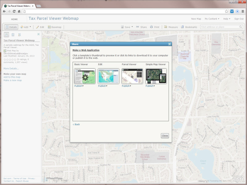
The model organization isn’t the only thing we’re doing to make it easier for you to leverage ArcGIS Online.  We’re also developing a series of ArcGIS Online web application templates for our local government users.  These application templates will be available natively in ArcGIS Online. They will allow users to author a web map and select a local government application when they share that map.  We’re starting with an online version of the Tax Parcel Viewer.
Over time, we’ll continue to add web application templates to ArcGIS Online.  These application templates will complement the applications we already provide in the solution.  This means you’ll be able to maintain the applications you’ve already deployed with your authoritative content and leverage new ArcGIS Online applications in your organization.
This is just the beginning for the local government solution offering in the cloud.  As we incrementally roll out new ArcGIS Online applications, you’ll be able to leverage the cloud solution to configure new maps and apps that were previously only available on your local computing infrastructure.
New Maps and Apps
So that was a quick overview of how ArcGIS Online will play a large role in the local government solution in 2013.  And at the same time we’re providing new ArcGIS Online capabilities, we will also be enhancing the current portfolio of HTML5/JavaScript applications to make them more robust, configurable, and compatible with the ArcGIS Online platform. The enhancements include:
  • Support for ArcGIS Online Hosted feature services
  • Configurable Locators (locally hosted or from the newly launched geocode.arcgis.com)
  • Support for the latest JavaScript APIs
  • Standard code base for common components like search, share, etc.
  • Additional code documentation
In all, we’ll be updating approximately twelve ArcGIS for Local Government apps in our next release.  In 2013, we will also be expanding the solution offering.  Let’s take a closer look at a few of the maps and apps we have planned.
Law Enforcement:
Data Management – A series of editing maps and tools used to manage fundamental law enforcement data, integrate data from external business systems (CAD, Records, AVL, etc.), and share it with other law enforcement professionals.
Cell Phone Analysis – A series of maps and tools used to estimate the location of a suspect’s and/or victim’s cell phone at a given time(s) of the day.
Pre-Incident Site Surveys – A series of maps that support the collection and inspection of pre-incident information for at-risk sites (ex. schools) in a community. This will be a coordinated with the Pre-Fire Planning and Special Event Planning Maps.
Crime Mapping – A series of operational management and reporting maps used in ComStat, daily resource allocation, neighborhood policing, and public information activities.
Fire Service:
Pre-Fire Planning 2.0 – A series of maps that support the collection, maintenance and inspection of pre-fire or pre-incident data.  This will be a major enhancement to the existing Pre-Fire Planning map and will be a coordinated with the Pre-Incident and Special Event Planning Maps.
Target Hazard Mapping – A series of tools used to assign hazard/risk ratings to buildings and properties and identify candidates for Pre-Fire Planning maps.
Hydrant Inspection – A series of maps that support the inspection and maintenance of hydrants for the fire service community.
Emergency Management:
Public Safety COP – The last release of the Flex-based Public Safety COP.  The final release will leverage work done on the National Guard Patriot Viewer and include a series of new widgets for the EM community.
Emergency Services – An adaption of the current My Government Services application that provides citizens evacuation, hazard and shelter information during an emergency.
Economic Development:
Development Showcase – An application that allows local governments to showcase properties in their community that are available for development.
General Data Management:
Data Reviewer for Basemaps – A series of ArcGIS Data Reviewer batch jobs that help local governments improve the quality of fundamental layers used in basemaps.
Data Reviewer for Parcel Management – A series of ArcGIS Data Reviewer batch jobs that help local governments improve the quality of parcel information managed with the ArcGIS parcel management solution.
In summary, this is going to be an exciting year for the ArcGIS for Local Government community.  Our releases will coincide with major releases of ArcGIS and each release will include newly developed maps and apps, updates to existing maps and apps, bug fixes reported by the community, and new ArcGIS Online functionality.
We’ll provide more details on each of these initiatives as we get closer to our actual release.  Please continue to use the Forums to contact us for help, provide feedback, and share your experiences with others.

Tuesday, December 11, 2012

ArcObjects or the ArcGIS Runtime SDKs for Java and WPF—which is right for you?


There has been lots of  excitement about building custom applications for the desktop with the new Runtime SDKs for Java and WPF, there are also important questions from our developers, like “Should I migrate from ArcGIS Engine?” and “If I migrate, what pieces of my code will I need to rewrite?”
New developers are also asking questions, like, “Since both ArcObjects/ArcGIS Engine and the new Runtime SDKs support development of custom desktop GIS applications, which is right for me?”

If you’re migrating

Esri will continue to have updates to ArcObjects. Version 10.1 was released earlier this year and 10.1 SP1 became available in October.
If your application is in Java, you’ll likely want to take advantage of the overwhelming benefits that ArcGIS Runtime SDK for Java has over ArcObjects for Java. To help you with this effort, here’s the first article in a series to help make the move to ArcGIS Runtime.
If your application is in .NET, the decision of whether or not to migrate should depend on the capabilities in your existing application that you want to keep. Not all the capabilities of ArcObjects is supported by the Runtime SDKs, so you’ll want to have a good understanding of what is and what isn’t supported before you migrate. If you’ve created any custom ArcObjects, such as custom renderers, custom data sources, or custom symbols, you cannot migrate those to a ArcGIS Runtime application.

If you’re starting fresh

Below is a list of capabilities that you can include in your custom desktop application if you are programming with ArcObjects. These capabilities are not available in ArcGIS Runtime SDK for Java and WPF at this time, so you must use ArcObjects to get them:
  • 3D visualization. Although you can perform 3D analysis in the Runtime SDKs, you cannot display 3D in your application at the current release.
  • Data management and complex features. If you want your application to create, manage, or maintain geodatabases (whether file or enterprise) you must use ArcObjects. Runtime SDKs support reading all aspects of the geodatabase and editing/updating simple features only. Editing of complex features (parcels with topologies, the parcel fabric, network datasets, and geometric networks) is not supported in the Runtime SDKs but is supported in ArcObjects.
  • Building a map that is a map authoring product or cartographic product requires ArcObjects. For example, if you have your application start with a blank screen, have the user browse for data, symbolize the data, set up the labeling, rendering, and scale dependency—this all requires ArcObjects.
  • Some extensions are not available in the Runtime SDKs. Schematics and Data Interoperability are available only with ArcGIS for Desktop and ArcGIS Engine.
Here are some resources to help you get started with ArcGIS Runtime SDK if you are new to ArcGIS or an existing ArcGIS Engine developer.

Tuesday, November 20, 2012

Improvements to product library at 10.1 – building business rules


Manage your field configurations and associate batch jobs directly in the Product Library window
In a previous blog, I outlined how product library’s user experience has been simplified at 10.1. Today I’ll explore how we have made it much easier to build your business rules. When using product library for managing your editing, there … Continue reading 
Posted in Editing | Tagged  | Leave a comment

Accelerating map cache creation

It can take a long time to create an ArcGIS Server map cache that covers large scales over a broad area. This post describes some of the biggest factors that affect caching speed. You can read other more detailed considerations in Tips and Best Practices for Map Caches.

Use local file geodatabases

If you can place a copy of the source GIS datasets on the server, you’ll notice greater speed and stability during cache creation. The caching process makes thousands or even millions of requests for data, and if those requests don’t have to leave the machine, your tiles will draw more rapidly.
The ideal approach is to place an identical file geodatabase at an identical path on each GIS server machine in your cluster. Register the file geodatabase’s local folder with ArcGIS Server as a data store item. Within your map document, use local paths to the data.

Avoid projection on the fly

For the best performance, project your source data into the same coordinate system as your map to avoid projection on the fly. People naturally hesitate to put their working databases in a projection like Web Mercator. However, the data you put on the server could be a one-way replica of your production database that might only exist for the purpose of creating the cache and satisfying user queries.

Choose antialiasing levels carefully

Antialiasing is a technique that ArcGIS uses to smooth the edges of lines and labels so they don’t appear pixilated. Text antialiasing has little impact on performance, but feature antialiasing is a computationally intensive action that slows caching.
Applying at least some level of feature antialiasing can make your vector map look more professional. Just be aware that each increase in antialiasing quality can greatly extend the amount of time it takes to make a cache. The Fastest or Fast settings are good enough for most caches. Avoid the higher quality settings such as Best unless your own test caches have shown you need that level of quality.

Fully utilize your CPU without overworking it

For the fastest tile creation, your CPU should be working near 100% during the tile creation, but should not be maxed out at 100%. You can watch your system activity using tools like Windows Task Manager or Performance Monitor.
Because each map is different, achieving this level of CPU usage may require some trial and error with your cache settings. There are two major settings that affect how much server power you dedicate toward caching:
  • The maximum number of instances of the CachingTools service that are allowed to run on each machine in the cluster. A good starting value for this is n + 1, where n is the number of CPU cores in a typical machine in your cluster.
  • The maximum number of instances of CachingTools that your cache job is allowed to utilize for the cluster as a whole. A good starting value is the default you see when you run Manage Map Server Cache Tiles. This reflects the number of machines in your cluster and the maximum number of CachingTools instances each is allowed to run. If you anticipate adding other GIS server machines during the caching job, enter -1 to remove the cap on the number of instances.
The values recommended above are just a starting point for your own testing and iteration. See Allocation of server resources to cachingfor more details and formulas for setting these values.

Create only the tiles you need

You don’t always need to create tiles across the full extent of your map at all scales. Some tiles are visited frequently and other tiles are never visited, especially in places where data is sparse at large scales.
Before starting a cache job, carefully plan which geographies and scales you must pregenerate and which tiles could be generated on demand (or displayed with a “Data not available” tile as described here). The small scales aren’t a problem because they require relatively few tiles. It’s the large scales that require a more strategic approach.
Create a feature class to delineate the most interesting and important areas of your map. When you cache your large scales, use this feature class to constrain tile creation. A feature class with many thousands of vertices can slow down the caching tools, so you may need to generalize it first using a tool such as Simplify Polygon.
With some planning, you can avoid creating thousands of tiles outside your geography of interest or tiles devoid of features.

More tips

Finally, consider these additional tips for accelerating your caching:
  • Avoid the exploded format cache. It takes longer to generate and is more cumbersome to move around. Stay with the default compact format.
  • Sometimes antivirus software can drain resources from the cache generation, especially if the new files are being scanned at creation time. If you suspect that antivirus is competing with ArcGIS Server for memory or CPU resources, get permission from your system administrator to temporarily disable or suppress the antivirus while you build the cache.
  • If speed is more of a problem than amount of required disk space, avoid the optimized PNG format cache introduced at ArcGIS 10.1. This format is great for reducing cache size, but it can take longer to build because it must determine the optimal bit depth for each tile. Consider using the MIXED format as an alternative.
  • When you analyze your map document before publishing, fix as many of the performance warnings as possible. For example, you will see an analyzer warning if your dataset does not have a spatial index. Taking the time to build a spatial index could result in faster map service draw times and tile creation.
Contributed by Sterling Quinn of the ArcGIS for Server development team
Posted in ServicesWeb | Tagged  | Leave a comment

Improvements to product library at 10.1 – building business rules


Improvements to product library at 10.1 – building business rules

Manage your field configurations and associate batch jobs directly in the Product Library window
In a previous blog, I outlined how product library’s user experience has been simplified at 10.1. Today I’ll explore how we have made it much easier to build your business rules. When using product library for managing your editing, there … Continue reading 
Posted in Editing | Tagged  | Leave a comment

Sunday, November 11, 2012

ArcGIS 10.1 and Windows 8


ArcGIS 10.1 and Windows 8

Microsoft has recently released Windows 8 and we have just released ArcGIS 10.1 Service Pack 1.  I’m pleased to announce that Windows 8 and Windows Server 2012 are now supported operating systems for ArcGIS 10.1 SP1.
Posted in Analysis & Geoprocessing, Developer, Mapping | Tagged , , , , , | 1 Comment

How to build an Apple Map app for iOS using the ArcGIS Runtime SDK for iOS


How to build an Apple Map app for iOS using the ArcGIS Runtime SDK for iOS

photo1
With the new release of iOS 6, Apple replaces the Map app from Google maps to create its own map application. Even though the new application from Apple has exciting new features, like 3D maps, some users are complaining about … Continue reading

Thursday, August 30, 2012

Consuming WebMaps from ArcGIS.com with ArcGIS Runtime for iOS


Screen Shot 2012-08-17 at 9.43.43 AM
ArcGIS Online brings the concept of WebMaps, a ready to use intelligent map that includes a way to “mashup” of all your data. WebMaps are highly configurable for any user wanting to tell a story or share their geographic information. … Continue reading