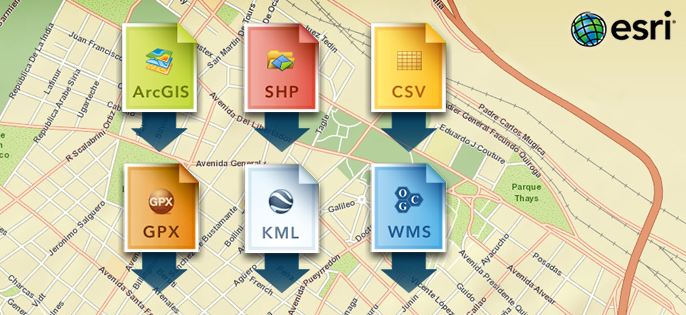
Pages

Wednesday, June 6, 2012

Drag and Drop Files on Your Web Map


With the
latest release of ArcGIS Online, you can now add shapefiles, text files (TXT
and CSV), and GPX files directly to your web map. You can drag data from
your computer onto your map or, with just the click of a button, add it to your
map in the ArcGIS.com
map viewer
 or ArcGIS
Explorer Online
. Once you’ve added your data, you can configure pop-up
windows and change the symbols.
When you
add your data to a web map, the ArcGIS.com map viewer and ArcGIS Explorer
Online automatically add the location information from your file, draw features
for each item, and store the information in the map.
In
addition to the above-mentioned formats, you can also add Open Geospatial
Consortium, Inc. (OGC), Web Map Service (WMS) layers to the ArcGIS.com map
viewer and ArcGIS Explorer Online. Simply click the Add button and
enter the URL to the service. The ArcGIS.com map viewer also supports the
addition of KML layers.
You can
share your data or saved maps in ArcGIS Online so others can find them and use
them to create their own maps and mashups.
 Learn
more
 about adding features to your map, or watch a
short video.

Tuesday, June 5, 2012

Google introduced indoor maps inside the new Google Maps 6.0 for Android


What Google Indoor Maps Really Mean for Retailers

A Google Maps™ screenshot from Android™
Google introduced indoor maps inside the new Google Maps 6.0 for Android last week. We did a simple experiment.
As a shopper, we zoomed into one of the indoor maps of a local Home Depot and searched for “paint.” We were automatically repositioned to the Lowe’s hardware store down the road.
Not what we – or Home Depot – expected.
Google can help get customers to the front door of the store. But what happens after the customer goes into the store – both virtually and physically – needs to be carefully evaluated.
For customers, it’s a likely win. Customers get helpful information on how a store is set up, where to find products and, potentially, relevant deals.
For retailers, it’s not so straightforward. Google’s announcement talked about indoor maps and location technologies, but their business model remains unrevealed.

Apple to Cut Google Out of Stunning New 3D Maps App in iOS6


Android Payback: Apple to Cut Google Out of Stunning New 3D Maps App in iOS6


New Apple maps image based on C3 3D technology

Monday, June 4, 2012

Ten quick references for map makers


By Alex Tait, Chief Cartographer and Vice President, International Mapping
Practical Cartographer References - Thumb
At the North American Cartographic Information Society (nacis.orgconference in October, I presented a list of 10 quick references for mapmakers. These are the scraps of paper on my bulletin board next to my computer. Some are photocopies of key pages out of books, others are screen captures from useful web pages, and some things I’ve jotted down freehand as I’ve worked with maps over the years.

Esri picture marker symbol generator for JavaScript developers


The ArcGIS.com map viewer provides a nice collection of picture marker symbols that can be used to symbolize features on your map. If you’re a developer, you might wonder how you can use these symbols in your applications. You could potentially use tools like Firebug or Chrome Developer tools to inspect ArcGIS.com and discover the image URL, but to make things easier, we’ve created a sample that allows you to select a symbol and generate the JavaScript Object Notation (JSON) needed to draw the symbol:

When using this sample, just click a symbol and

SWAT: Soil & Water Assessment Tool


What is SWAT?
A sophisticated basin-scale computer model that predicts impacts of weather, soils, land use and land management on water supplies and pollution as well as  soil erosion, fertility and crop production.
This model contributes to understanding the complex ecosystem and its service to water availability, water quality; food vulnerability and food production; as well as socioeconomic demography issues worldwide.
The Soil and Water Assessment Tool, or SWAT model, is a public domain model developed by a group of scientists from the USDA-Agricultural Research Service; USDA-Natural Resources Conservation Service, and Texas A&M University.

Fonts in ArcGIS symbols


By Aileen Buckley, Mapping Center Lead
Fonts in ArcGIS Symbols - Thumbnail
There are three primary building blocks of standard symbols in ArcGIS – colors, fonts, and graphic files. In this article, we focus on fonts for standard 2D symbols in ArcGIS. In other blog entries, we discuss colors and pictures in ArcGIS symbols. Here, we discuss fonts used in character marker symbols, marker line symbols, and marker fill symbols. We also discuss the need to install fonts so that symbols display correctly and to embed fonts in shared output documents.